
Introduction
Geofencing tools are location-based technologies that create virtual geographic boundaries around real-world locations and trigger actions when a device, vehicle, or person enters or exits those boundaries. These tools combine GPS, RFID, Wi-Fi, cellular data, and mapping intelligence to enable real-time location awareness and automated workflows.
In today’s data-driven world, geofencing plays a critical role in marketing, logistics, workforce management, security, smart cities, and IoT ecosystems. From sending contextual notifications to customers near a store, to tracking fleet movement and preventing unauthorized access to sensitive zones, geofencing bridges the gap between the physical and digital worlds.
When choosing a geofencing tool, buyers should evaluate accuracy, scalability, ease of configuration, integration capabilities, analytics depth, security standards, and compliance readiness. A strong platform should offer reliable location detection, flexible rule creation, real-time alerts, historical reporting, and seamless integration with existing systems.
Best for:
Geofencing tools are ideal for marketing teams, logistics operators, fleet managers, HR and workforce leaders, retailers, smart city planners, and enterprises managing distributed assets or mobile users.
Not ideal for:
They may be unnecessary for static businesses with no location-based workflows, very small teams without mobile assets, or organizations where privacy or regulatory constraints prohibit location tracking.
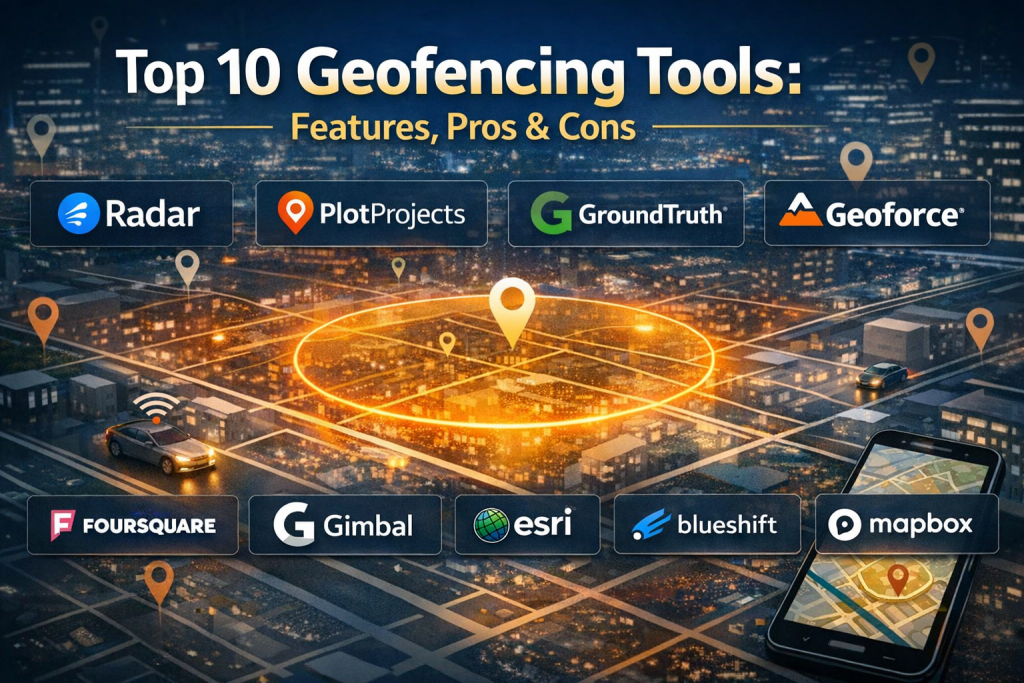
Top 10 Geofencing Tools
1 — Radar
Short description:
A developer-friendly geofencing and location intelligence platform designed for modern apps and digital products.
Key features:
- High-accuracy polygon and radius geofences
- Real-time entry and exit triggers
- SDKs for mobile and web applications
- Location analytics and dwell time insights
- Fraud detection and location verification
- Scalable API-first architecture
Pros:
- Excellent accuracy and reliability
- Strong developer documentation
Cons:
- Less suited for non-technical teams
- Pricing scales with usage
Security & compliance: SOC 2, GDPR, encryption in transit and at rest
Support & community: Strong documentation, responsive support, active developer community
2 — PlotProjects
Short description:
A mobile-focused geofencing and proximity marketing platform built for customer engagement.
Key features:
- Geofence-based push notifications
- Beacon and Wi-Fi proximity detection
- Campaign automation workflows
- Audience segmentation
- Analytics and conversion tracking
- CRM and marketing integrations
Pros:
- Easy setup for marketers
- Strong engagement analytics
Cons:
- Limited non-marketing use cases
- Dependent on mobile app adoption
Security & compliance: GDPR-ready, standard encryption
Support & community: Good onboarding guides and customer support
3 — GroundTruth
Short description:
An enterprise-grade geofencing and location analytics solution for advertising and insights.
Key features:
- Large-scale geofence creation
- Real-world visitation analytics
- Audience behavior insights
- Attribution and performance measurement
- Privacy-first data modeling
- Enterprise reporting dashboards
Pros:
- Extremely rich location data
- Strong enterprise credibility
Cons:
- Premium pricing
- More complex setup
Security & compliance: GDPR, CCPA, enterprise data controls
Support & community: Dedicated enterprise support teams
4 — Geoforce
Short description:
A robust geofencing platform focused on asset tracking and industrial operations.
Key features:
- Asset-based geofences
- Satellite and cellular tracking
- Automated alerts and escalations
- Harsh-environment support
- Long-term historical tracking
- Compliance reporting
Pros:
- Ideal for industrial assets
- High reliability in remote areas
Cons:
- Not designed for marketing use
- Hardware dependency
Security & compliance: ISO-aligned security, encryption
Support & community: Strong enterprise onboarding and training
5— HERE Technologies
Short description:
A mapping and location intelligence platform offering advanced geofencing for enterprises.
Key features:
- High-precision global maps
- Dynamic geofencing APIs
- Traffic-aware location rules
- Fleet and logistics optimization
- IoT and automotive integrations
- Scalable cloud infrastructure
Pros:
- Global coverage
- Highly accurate mapping
Cons:
- Requires technical expertise
- Pricing complexity
Security & compliance: GDPR, ISO standards, enterprise security
Support & community: Extensive documentation and enterprise support
6 — Foursquare
Short description:
A location data and geofencing solution emphasizing real-world consumer behavior.
Key features:
- Place-based geofencing
- Foot traffic analytics
- Audience segmentation
- Real-world attribution
- Location intelligence APIs
- Trend analysis
Pros:
- Rich place data
- Strong analytics insights
Cons:
- Primarily analytics-driven
- Less operational tooling
Security & compliance: GDPR, privacy-centric design
Support & community: Good documentation, enterprise support
7— Gimbal
Short description:
A geofencing and proximity platform optimized for mobile engagement and analytics.
Key features:
- Geofence and beacon support
- Contextual messaging triggers
- Audience insights
- Campaign analytics
- SDK-based deployment
- Cross-channel integrations
Pros:
- Strong mobile performance
- Mature analytics engine
Cons:
- Mobile-centric limitations
- Requires app integration
Security & compliance: GDPR, standard encryption
Support & community: Solid documentation and support services
8 — Esri
Short description:
A powerful GIS-based geofencing solution for spatial analysis and enterprise use.
Key features:
- Advanced polygon geofences
- Spatial analytics and visualization
- Real-time location feeds
- IoT and sensor integration
- Custom dashboards
- Enterprise GIS capabilities
Pros:
- Extremely powerful analytics
- Ideal for complex geospatial needs
Cons:
- Steep learning curve
- Higher cost
Security & compliance: Enterprise-grade security, ISO standards
Support & community: Large global user community and training ecosystem
9 — Blueshift
Short description:
A customer engagement platform with built-in geofencing for omnichannel marketing.
Key features:
- Location-triggered campaigns
- AI-driven personalization
- Cross-channel orchestration
- Customer journey mapping
- Analytics and reporting
- CRM integrations
Pros:
- Strong personalization engine
- Marketing-friendly UI
Cons:
- Limited non-marketing use
- Requires quality customer data
Security & compliance: GDPR, SOC 2
Support & community: Strong customer success teams
10 — Mapbox
Short description:
A flexible mapping and geofencing platform for developers and data teams.
Key features:
- Custom geofence creation
- Real-time location tracking
- Highly customizable maps
- Navigation and routing
- SDKs and APIs
- Scalable cloud services
Pros:
- Excellent customization
- Strong developer ecosystem
Cons:
- Requires technical skills
- Costs grow with usage
Security & compliance: GDPR, encryption standards
Support & community: Extensive docs and active developer community
Comparison Table
| Tool Name | Best For | Platform(s) Supported | Standout Feature | Rating |
|---|---|---|---|---|
| Radar | App developers | iOS, Android, Web | High-accuracy geofences | N/A |
| PlotProjects | Marketers | Mobile | Proximity marketing | N/A |
| GroundTruth | Enterprises | Web | Real-world analytics | N/A |
| Geoforce | Asset tracking | IoT, Web | Industrial reliability | N/A |
| HERE Technologies | Logistics | Web, API | Global mapping | N/A |
| Foursquare | Analytics teams | Web, API | Foot traffic data | N/A |
| Gimbal | Mobile engagement | Mobile | Contextual messaging | N/A |
| Esri | GIS professionals | Web, Desktop | Advanced spatial analysis | N/A |
| Blueshift | Marketing teams | Web | AI personalization | N/A |
| Mapbox | Developers | Web, Mobile | Custom maps | N/A |
Evaluation & Scoring of Geofencing Tools
| Criteria | Weight | Radar | Esri | Mapbox | GroundTruth |
|---|---|---|---|---|---|
| Core features | 25% | High | Very High | High | High |
| Ease of use | 15% | Medium | Low | Medium | Medium |
| Integrations & ecosystem | 15% | High | Very High | High | High |
| Security & compliance | 10% | High | Very High | High | High |
| Performance & reliability | 10% | High | High | High | High |
| Support & community | 10% | High | Very High | High | High |
| Price / value | 15% | Medium | Medium | Medium | Medium |
Which Geofencing Tool Is Right for You?
- Solo users: Lightweight tools with simple setup and predictable pricing
- SMBs: Marketing-focused or developer-friendly platforms with quick ROI
- Mid-market: Balanced tools offering analytics, integrations, and scalability
- Enterprise: GIS-grade accuracy, compliance, and dedicated support
Budget-conscious teams may prefer simpler marketing or SDK-based solutions, while regulated industries should prioritize security, auditability, and compliance. Always align feature depth with actual operational needs.
Frequently Asked Questions (FAQs)
- What is geofencing used for?
Geofencing enables automated actions based on location, such as alerts, tracking, or engagement. - Does geofencing require mobile apps?
Not always; some platforms support IoT, vehicles, or web-based tracking. - How accurate is geofencing?
Accuracy depends on GPS quality, device sensors, and platform algorithms. - Is geofencing legal?
Yes, when implemented with user consent and privacy compliance. - Can geofencing work indoors?
Some tools use Wi-Fi and beacons for indoor positioning. - Is geofencing expensive?
Costs vary by scale, usage, and feature depth. - Does it drain battery life?
Modern platforms optimize location polling to reduce impact. - Can geofencing integrate with CRM systems?
Many tools offer native or API-based integrations. - What industries benefit most?
Retail, logistics, marketing, healthcare, construction, and smart cities. - What is a common mistake when implementing geofencing?
Over-complicated rules without clear business objectives.
Conclusion
Geofencing tools have become essential for organizations that rely on location-aware intelligence and automation. From marketing engagement to fleet control and spatial analytics, these platforms unlock powerful real-world insights.
The most important factors when choosing a geofencing tool are accuracy, scalability, integration fit, security, and usability. There is no single “best” solution for everyone—the right choice depends on your industry, team size, technical maturity, and business goals. By aligning tool capabilities with real needs, organizations can turn location data into measurable impact.

Find Trusted Cardiac Hospitals
Compare heart hospitals by city and services — all in one place.
Explore Hospitals
Geofencing systems need to account for location errors before triggering actions based on device movement. Weak GPS signals can make a device appear to cross a boundary even when it has barely moved. Testing with different devices and real-world signal conditions can help uncover these issues early. Teams can also apply short waiting periods and accuracy checks to prevent repeated alerts. This reduces false notifications and helps field staff trust the location events they receive.
Geofencing tools enable businesses to trigger location-based actions when devices enter or leave predefined geographic boundaries. Accurate location detection, flexible boundary configuration, and timely notifications can support applications such as fleet coordination, retail engagement, and field workforce management. Reliable performance also depends on battery efficiency, platform compatibility, and transparent consent practices that protect user privacy while delivering useful location-aware services.
Geofencing tools help businesses create virtual boundaries around specific locations and trigger actions when devices enter or leave those areas. They are useful for location-based alerts, marketing, and tracking field activities. I think accurate location tracking and easy setup are important features to consider. These tools can help businesses improve their services and manage operations more efficiently. Strong privacy controls are also important when collecting location data.
Geofencing tools trigger actions when a device enters or leaves a defined location. They can support delivery updates, asset tracking, and location-based services, but accuracy depends on the device and environment. I would compare boundary setup, event reliability, battery impact, and integration options. Teams should test locations with poor GPS coverage and check how the system handles repeated boundary crossings. Privacy and consent are important when tracking people or personal devices. Clear controls should explain when location data is collected and used. A good geofencing tool should deliver dependable events while limiting unnecessary tracking and false alerts.
Geofencing systems need safeguards against unreliable location signals and repeated event delivery. A phone moving near a boundary may repeatedly switch between inside and outside states, triggering duplicate notifications or workflows. Developers should use sensible distance thresholds, event deduplication, and time-based validation before taking action. It is also worth testing how the system behaves in dense urban areas, underground parking, and places with weak GPS reception. Tracking false triggers and missed entries during pilot deployments can help teams tune these rules before expanding to more locations. This reduces unnecessary alerts and prevents location errors from disrupting customer experiences or operational processes.
Geofencing tools need to balance accurate location-based triggers with battery usage and privacy requirements. When comparing platforms, check how they handle GPS drift, overlapping boundaries, and delayed location updates that can trigger alerts at the wrong time. Configurable entry and exit rules, along with clear consent controls and location data retention settings, can make geofencing more reliable and appropriate for different use cases.
From a real-time systems perspective, the critical engineering constraint in geofencing platforms is balancing location precision with client-side battery drain and backend ingest latency. Without intelligent spatial indexing (such as Uber’s H3 or Google’s S2) and dynamic GPS-to-cellular polling fallback, handling high-concurrency polygon containment queries at scale quickly overwhelms serverless workloads.
Geofencing tools let businesses create virtual boundaries around physical locations and trigger alerts or actions when devices enter or leave those areas. When comparing platforms, consider location accuracy, real-time alerts, battery usage, privacy controls, and integration with existing apps or tracking systems. Testing boundaries in different environments can help reduce false alerts, while clear consent and data retention rules protect users’ location privacy.
Geofencing tools allow businesses to create virtual boundaries around specific locations and trigger notifications, alerts, or automated actions when devices enter or leave those areas. Platforms like Radar provide location tracking, geofence management, and location-based analytics, helping organizations improve customer engagement, optimize delivery operations, and build more relevant location-aware experiences.
Choosing the right geofencing tool often comes down to handling edge cases like battery drain versus GPS accuracy in mobile SDKs. While polygon boundaries offer great precision over simple radius zones, managing frequent enter-and-exit event spikes without overwhelming your backend telemetry requires careful consideration. It would be interesting to see how these compared platforms handle offline queuing when devices lose cellular connectivity in remote areas.
A reliable geofencing solution needs to balance location accuracy with battery usage, privacy, and real-time alert performance. Testing geofence boundaries in real-world conditions and setting clear data-retention policies can help teams avoid false triggers while maintaining user trust.
This article does an excellent job demystifying the often complex world of geofencing tools by explaining not just what the leading platforms are, but also why their specific features matter across different real‑world use cases — from marketing engagement and fleet tracking to spatial analytics and IoT workflows. I particularly appreciate the practical evaluation of strengths and limitations, such as developer friendliness, marketing‑oriented interfaces, enterprise‑grade analytics, integration flexibility, and compliance readiness, which are crucial when selecting a tool that fits both technical and business needs. The side‑by‑side pros and cons, combined with clear use‑case guidance, make this comparison a helpful resource for teams evaluating geofencing for location‑based notifications, asset monitoring, customer behavior insights, or smart infrastructure planning.